Release Notes
v5.4
GeoSWMM Version 5.4
November 27, 2025
GeoSWMM for ArcGIS Pro version 5.4 introduces major enhancements to the Watershed Delineation Tool along with several improvements and bug fixes designed to streamline workflows and improve modeling accuracy.
New Features
Urban Subcatchment Delineation Using Sewer Network Data
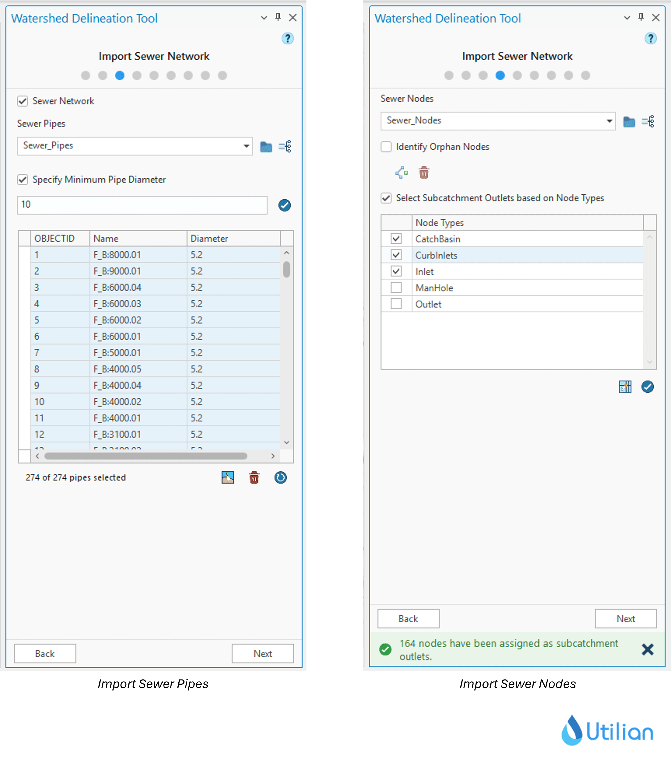
The Watershed Delineation Tool now includes a dedicated workflow for urban catchment delineation using storm sewer or drainage network data. Users can import sewer pipes, manholes/inlets, and other drainage structures directly into the tool to generate subcatchments that reflect both natural terrain and manmade drainage systems.
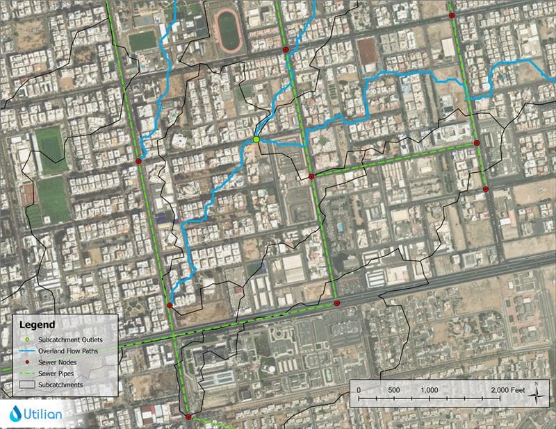
This enhancement allows modelers to align subcatchment boundaries with the actual storm sewer network, essential for accurately representing urban hydrology where flow directions are strongly influenced by underground pipes. The updated workflow includes:
- Sewer Network Import: Seamlessly import storm sewer pipes and nodes into the delineation environment.
- Customizable Network Editing: Modify, adjust or refine imported drainage network before delineation.
- Integrated Delineation Options: Support for natural drainage systems, pipe networks, open channels, or combined drainage systems.
- Improved Stream Alignment: Automatically align natural flowpaths with the sewer network and identify where streams overlap pipes.
- Valid SWMM Connectivity: Ensures delineated subcatchments correctly connect to corresponding sewer nodes/pipes in the generated SWMM model.
Resolved Issues:
Issue Name | Description |
|---|---|
Optimizations in Width Calculation Tool | Improved the workflow for identifying headwater channels in both natural and urban watersheds. Subcatchment width—particularly in headwater areas—is now calculated more accurately and consistently. |
Blank Features Created During 2D Layer Generation | Resolved a rare case where certain 2D features were generated as blank when an obstruction layer was used during the Create 2D Layers process. All 2D layers now generate correctly when obstruction data is present. |