Software with the Modeler in Mind
From model preparation to validation and visualization, GeoSWMM streamlines the stormwater simulation workflow.


Seamless Model Setup
GeoSWMM makes it easy to build the geometric components of a stormwater model from scratch.
Watershed Delineation Tool
Watershed Delineation Tool
Delineate watershed boundaries for hydrologic modeling
Specify areas of interest with custom DEM clipping tools
Refine DEMs with stream burning in feature for accurate channel representation
Create and manage stream layers for delineated watersheds
Assign outlets at stream confluences with intuitive tools

Delineate Surface Flow Path
Delineate Surface Flow Path
Delineates overland flow paths from storm nodes or manholes for overflow or all nodes
Generates SWMM-compatible flow path networks ready for dual-drainage modeling
Captures surface–sewer interactions for more realistic urban drainage analysis
Integrates directly into GeoSWMM simulations within ArcGIS Pro

ID Mapper Tool
ID Mapper Tool
Assign inlets and outlets to conduits instantly
Capture critical flow direction automatically
Save time, minimize errors

GIS-Based Model Builder
GIS-Based Model Builder
Extract attributes from external GIS data and assign to model components
Store model data in an ArcGIS Pro-compatible geodatabase
Integrate hydraulic, hydrologic, and spatial data in one database
Maintain data integrity by removing external file dependencies

Import and Export EPA SWMM Files
Import models directly from EPA SWMM .inp files
Export models to EPA SWMM .inp files.
Validate data and coordinate systems during import


Faster Model Preparation
GeoSWMM's interactive features help you capture model inputs directly from GIS data while automating time-consuming steps and calculations in the process.
Land Use/Land Cover Properties Tool
Land Use/Land Cover Properties Tool
Reclassify land cover data for SWMM models
Assign Manning's N and depression storage values from reference tables
Save and reuse land cover mappings
Calculate subcatchment land use characteristics

Conduit Roughness Calculator
Conduit Roughness Calculator
Set roughness values based on conduit material (e.g., PVC, cast iron, earthen)
Determine roughness from conduit cross-section type (e.g., rectangular, irregular) and material
Apply roughness values from SWMM tables or external data


Imperviousness Calculator
Imperviousness Calculator
Compute area-weighted imperviousness for each subcatchment
Use raster or polygon data to determine surface imperviousness

Subcatchment Width Calculator
Subcatchment Width Calculator
Calculate subcatchment characteristics width using multiple methods for accuracy
Adjust headwater channel lengths for improved hydrologic representation

Subcatchment Slope Calculator
Subcatchment Slope Calculator
Calculate average slope of subcatchments from DEM data
Use weighted raster cell averages for accurate slope representation


Enhanced Quality Control
GeoSWMM goes beyond standard ArcGIS Pro capabilities with purpose-built tools that automatically identify issues in your model and guide you through fixes.
Network Analysis Tool
Network Analysis Tool
Detect and visualize network connectivity issues directly in ArcGIS Pro
Highlight disconnected segments, missing or duplicate features
Flag and clean invalid geometry including duplicates and overlaps.

Control Rules Editor
Control Rules Editor
Simplify control rule management with a guided, user-friendly editor
Create rules quickly through point-and-click inputs
Validate instantly before saving or exiting the editor

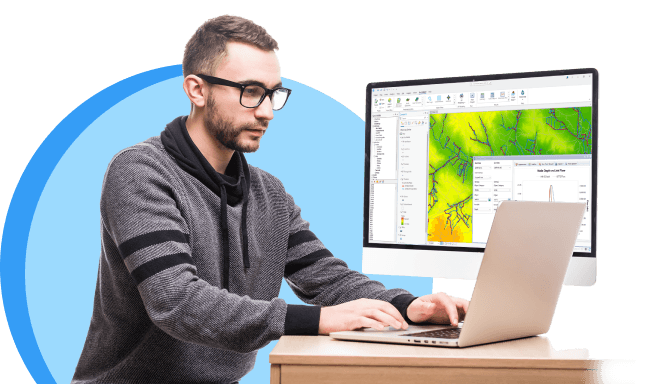
Simulate the Full Story
Which building will be damaged in a flood? Which pipes will be surcharged, and when? GeoSWMM leverages ArcGIS Pro to translate models and maps into meaningful outcomes.
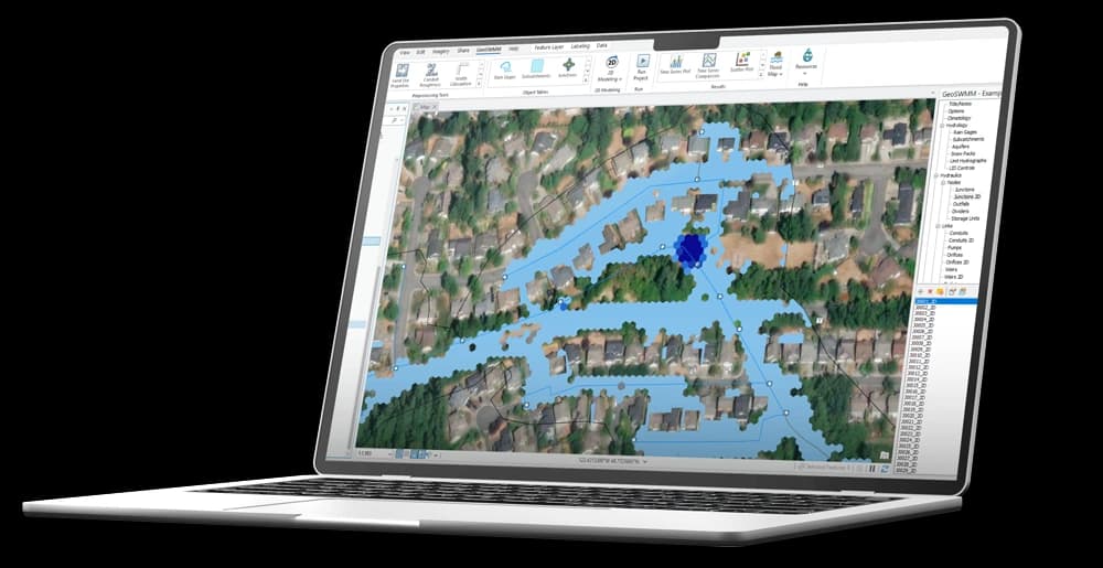
Flood Mapping Tool
Flood Mapping Tool
Generate precise flood depth and extent maps using model results
Simulate quasi-2D modeling to capture realistic flood behavior
Exports flood maps in GIS-compatible formats (e.g., GeoTIFF, shapefile)
Identify flood-prone areas to guide risk assessment and mitigation planning

Time Series Plots
Time Series Plots
Compare and analyze variables (e.g., flow vs. depth) across model components
Explore time series through graphical and tabular formats
Evaluate simulated outputs with observed data for calibration and validation
Export results to external formats (e.g., JPG, PNG, XLSX, CSV) for reporting and further analysis

Scatter Plots
Scatter Plots
Visualize trends and correlations across hydraulic or water quality variables with customizable plots
Select specific nodes, links, or subcatchments for focused analysis
Customize chart elements (e.g., scales, annotations, and styling) for clear communication and effective presentation
Export plots in graphical or tabular formats for reporting and documentation

Profile Plots
Profile Plots
View all possible flow paths between selected start and end nodes
Generate water surface elevation profiles along defined paths
Simulate temporal changes in water surface elevation with adjustable controls
Pause, advance, or rewind simulations for detailed analysis

Launch GeoSWMM
Experience the benefits of GeoSWMM—your software for stormwater and flood modeling.