Transects
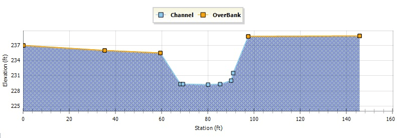
Transects refer to the geometric data that describe how bottom elevation varies with horizontal distance over the cross section of a natural channel or irregular-shaped conduit. Fig. 54 displays an example transect for a natural channel.

Fig.54: Example of a Natural Channel Transect
Each transect must be given a unique name. Conduits refer to that name to represent their shape. A special Transect Editor is available for editing the station-elevation data of transect. GeoSWMM internally converts these data into tables of area, top width, and hydraulic radius versus channel depth. In addition, as shown in the diagram above, each transect can have a left and right overbank section whose Manning's roughness can be different from that of the main channel. This feature can provide more realistic estimates of channel conveyance under high flow conditions.
