Extract Elevation Data
The Elevation Manager tool extracts ground elevation data from contour line. The primary purpose of this tool is to facilitate viewing water surface profiles with ground elevation data in Profile Plot. Clicking (
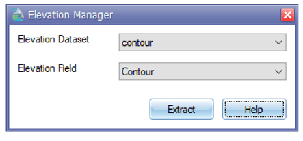
) will appear the main interface of the Elevation Manager tool (Fig. 111). This interface contains two input features and an operational feature. The Elevation Dataset field requires an elevation data layer as a line feature. The Elevation Field is an attribute field that contains the elevation value of the elevation data layer. Finally clicking Extract will extract the elevation of the conduit and junction layer.

Fig. 111: Elevation Manager window

