Slope Calculation Tool
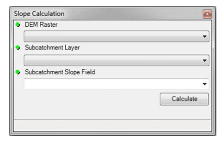
The "Slope Calculation" tool works with a Digital Elevation Model (DEM) dataset to find the average surface slope of the model subcatchments. The values are calculated in percentage rise. The tool requires a DEM raster and the subject subcatchment layer as input. In addition, an attribute column name needs to be specified where the tool will preserve the calculated slope value for each subcatchment. Users may assign a valid field name from the available columns in a drop-down list or insert a new field name. The interface of this tool looks like the following Fig. 97.

Fig.97: Subcatchment Slope Calculation Tool window
The characteristics of the required input features in the Slope Calculation tool are described below.
DEM Raster
This is a raster dataset that contains elevation values of the model subcatchment area.
Subcatchment Layer
This is a polygon feature layer that represents the subcatchments.
Subcatchment Slope Field
This is an attribute field available in the subcatchment layer in which the slope calculation tool will store the calculated slope values. If a new field name is assigned, then it will be added to the attribute table of the subcatchment layer.
